

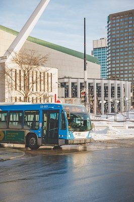
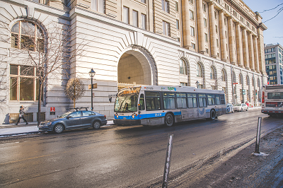
Explore Montréal using public transit
Maybe you wouldn’t take the métro to the dépanneur, but you have to admit that taking the 11 bus up Mont Royal is pretty great!
You know that Montréal is an island, but have you ever been for a swim in the St. Lawrence?
Have you really been to every borough of Montréal? Do you truly know the city like the back of your hand?
Discover Montréal by bus!
Celebrate by discovering Montréal by bus with one of our 16 suggested itineraries, on 20 regular bus lines, that will take you through the city’s different neighbourhoods.
Finally, don’t forget to purchase the right fare card for your outing.
Happy exploring!
The prestigious 24 Sherbrooke.
From La Fontaine Park to Notre-Dame-de-Grâce.
 © Simon Laroche
You can start by boarding the 24 bus line heading east at Villa-Maria métro station on the Orange line. You'll travel along Décarie Boulevard before reaching the Notre-Dame-de-Grâce, known simply as NDG, portion of Sherbrooke Street, a bustling, lively commercial and residential area.
Next comes the City of Westmount. The bus will take you past Westmount Park where you'll glimpse an array of buildings housing institutions such as Victoria Hall and Westmount’s magnificent library, before the stately city hall building comes into view. After this lush, green area, you'll cross Greene Avenue, with many cafés and restaurants that invite passers-by to linger a while.
 © Simon Laroche
Soon after, you'll travel past Montréal institutions such as Emmanu-El Beth Sholom synagogue and Dawson College, to reach another historically famous part of the city: the Golden Square Mile. Long known for its spectacular architecture, the neighbourhood is still studded with majestic homes. You'll see other major institutions along the way, including the Montréal Museum of Fine Arts, with its buildings installed on both side of the street, the McCord History Museum and the renowned Ritz-Carlton hotel.
 © Simon Laroche
Once you reach Saint-Denis Street, you’ll be only steps away from Saint-Louis Square, a picturesque area whose lovely facades have inspired many artists, including writers and musicians. A little further east, you'll come to the one-and-only, ever beautiful La Fontaine Park, where you can end your trip or begin it. With its sports fields, public art and walking paths, La Fontaine Park is a vibrant part of Montréal life. It's a lovely place to spend a few hours and the perfect point to start or end a discovery tour on the 24 bus line.
Discover more about the prestigious bus line 24 by listening to our podcast!
The electrifying 36 Monk.
From downtown to Sud-Ouest
The past, present and future collide along the route of the 36 Monk. This bus passes through some of the city’s oldest and most exciting neighbourhoods. It was also the line selected to test the three fully electric buses for the Cité Mobilité project, which is why there are impressive fast-charging stations at the line’s two terminus stops at Victoria Square and Angrignon Park.
 © Louis-Étienne Doré
If you’re lucky, you’ll end up on one of these ultra-quiet buses. But never fear, you’ll enjoy the trip just as much on a regular bus! Victoria Square, with its famous Paris métro station entrance, is a lovely place to wait for the bus to arrive. Once on board, you’ll travel down Saint-Antoine Street, where you’ll soon be surrounded by some of the landmark buildings of downtown Montréal: Place Victoria (the former Tour de la Bourse), Place Bonaventure and 1000 De La Gauchetière. Don’t be surprised to see a number of buses from other transit authorities, as this is where they end their routes before returning to the suburbs.
After Peel Street, you’ll pass the majestic Windsor Train Station and then the renowned Bell Centre, now surrounded by luxury high rises. You’ll go down Guy Street to reach Little Burgundy, a far less affluent neighbourhood perhaps, but one with a rich history nevertheless. It was the birthplace of legendary jazz musician Oscar Peterson, who appears on a Roadsworth mural at the corner of Saint-Jacques Street. On Notre-Dame, there’s no lack of trendy restaurants, as well as shops that hark back to the area’s former status as the antique district of the city. Near Charlevoix Street, you’ll see the lights of the old Corona Theatre’s marquee glittering once again.
 © Simon Laroche
West of Atwater Avenue and the famous Atwater Market, you’ll enter the neighbourhood of Saint-Henri. This part of Notre-Dame Street was entirely overhauled a few years ago, which makes the route even more pleasant today. At Sainte-Marguerite Street, the bus loops up to Saint-Jacques Street to stop at Place-Saint-Henri métro station, on Orange line so don’t be surprised when you pass a few shops on Notre-Dame Street for the second time! Though it has undergone many changes since the days of Gabrielle Roy’s novel Bonheur d’Occasion, Place Saint-Henri still has a certain feel about it, if only for its Art Deco fire station.
After an unavoidable trip under the new Turcot Interchange (a lot less scary than the old one), the bus crosses the Lachine Canal by way of Monk Boulevard. This is another of the area’s main streets, and though it is less of a tourist destination than Notre-Dame Street, it has some lovely shops just the same.
At the end of Monk, the bus drives momentarily along the Canal de l’Aqueduc before turning onto Des Trinitaires Boulevard. Here, you can’t miss Angrignon Park, a huge green space enjoyed by both local residents and Montréalers from all across the city. It’s a popular picnicking destination on beautiful summer days. Why not join in the fun?
The dynamic 51 Édouard-Montpetit.
From Plateau-Mont-Royal to Notre-Dame-de-Grâce.
Going west, the 51 starts on Saint-Joseph Boulevard and soon turns onto Saint-Laurent to head down Laurier Avenue West, a very lively street visited regularly by Mile-End and Outremont residents for the array of services found there.
 © Simon Laroche
The bus then makes its way through a more residential area along Chemin de la Côte-Sainte-Catherine. This tree-lined main thoroughfare of Outremont leads to Édouard-Montpetit Boulevard, where the feel shifts. This is the territory of Université de Montréal, one of the city’s four universities. The 51 services a number of the university’s main buildings, including the CEPSUM, its large sports complex. Spread out at the foot of Mount Royal’s northern slope, the campus is serviced by adjacent métro stations Édouard-Montpetit and Université-de-Montréal. The 51 has stops at both.
 © Simon Laroche
From Édouard-Montpetit Boulevard, the bus turns onto Chemin Queen Mary where the surroundings change again as Saint Joseph’s Oratory, also built on the mountain slope, comes into view. The oratory’s steep and wooded terrain is the perfect place for a beautiful hike away from traffic.
 © Simon Laroche
After the oratory, the 51 begins its descent toward Snowdon métro station, a point of transfer between the Blue and Orange métro lines. This is Notre-Dame-de-Grâce. On Fielding Street, as the route nears its end, apartment buildings give way to parks and then to private homes. Notre-Dame-de-Grâce is a large, heavily populated and dynamic Montréal neighbourhood with a rich history.
The line has its western terminus stop at the Montréal-Ouest exo train station. This is also the terminus stop for other buses, including the 105 Sherbrooke, which can take you back downtown along another route.
The elegant 66 The Boulevard.
From Westmount to Côte-Saint-Luc.
''This line is interesting with its view on the side of Mount Royal and beautiful vintage buildings.'' - Nelson Cunha - bus driver
 © Université Concordia
Hop aboard the 66 at its southern terminus stop near Guy-Concordia métro station on the Green line. The bus will begin its climb up Chemin de la Côte-des-Neiges, a packed and lively area with a real downtown feel, before turning onto The Boulevard, a thoroughfare that runs along the top of the City of Westmount. The road is steep here too—you’ll feel like you’re scaling the mountain.
At the corner of Chemin de Trafalgar, you’ll be close to Chemin Belvédère, from where you can walk to Summit Woods park. Walkers be warned: it’s a steep slope! But it’s worth the effort when you reach the lookout above the city. The view from here is magnificent, and in good weather, you can see all the way across the river.
 © Simon Laroche
Back on the 66, there’s much to discover along The Boulevard until Décarie. Between beautiful private homes, you’ll catch glimpses of old stone walls and stairs leading from one street to another, which give the neighbourhood a truly special feel. After Victoria Street, The Boulevard turns into Chemin de la Côte-Saint-Luc.
 © Simon Laroche
At Décarie Boulevard, you’ll be a short walk from Snowdon (Orange and Blue lines) and Villa-Maria (Orange line) métro stations. From this point, the ambience changes. This is where the municipalities of Hampstead and Côte-Saint-Luc meet the neighbourhood of Notre-Dame-de-Grâce. The houses have high, lovely facades that give the street a New York City feel at times.
The line ends near the border of Côte-Saint-Luc and Notre-Dame-de-Grâce. Close by, on Fielding Street, you can catch the 51 Édouard-Montpetit to get to Snowdon métro station by another route or take the 66 in the other direction to cross the elegant streets of Westmount a second time.
The riverside 68 Pierrefonds and 69 Gouin.
Along the Rivière des Prairies
''I love this line, especially in the summer, when you can go out to the beach at Cap-Saint-Jacques. Everyone’s in a good a mood. It’s mostly families with young children, which makes for a fun-filled atmosphere!'' - Lazid Rafik Mohamed, bus driver
The 69 Gouin starts at Cégep Marie-Victorin and goes along Henri-Bourassa Boulevard, travelling through the Montréal-Nord borough. At De Saint-Firmin Street in the Ahuntsic-Cartierville borough, you’ll be just steps away from Île-de-la-Visitation nature park, which is worth a detour at any time of year. With its wetlands, waterside trails and calm surroundings, it’s the perfect place to escape for a while. Go back in time and explore the Ancien Village du Sault-au-Récollet heritage site, including the majestic Église de La Visitation-de-la-Bienheureuse-Vierge-Marie, one of the oldest churches on the island.
 © Tourisme Montréal - Marie Deschene
The 69 continues west to Henri-Bourassa métro station, where the Orange line intersects with a number of bus lines. It then turns onto Gouin Boulevard to pass through Bordeaux and Cartierville, whose beautiful homes and large trees are testaments to the rich histories of these neighbourhoods.
At Grenet Street, transfer to the 68, which will take you to the Pierrefonds-Roxboro borough. At certain points along Gouin Boulevard West, you may almost feel like you’re in the countryside as you pass the Bois-de-Saraguay and Bois-de-Liesse nature parks, each with wooded areas and hiking trails.
 © Simon Laroche
''This route crosses Montréal from east to west. Part of the line takes you along Gouin Boulevard, with its attractive homes, near-century-old hospital and majestic trees. Remember the old Belmont Park and its attractions? I used to go there with my family in the 70s!'' - Martin Cyr, bus driver
Farther west after Pierrefonds, at the very end of the line, you’ll end up at the huge Cap Saint-Jacques nature park. You’ll feel pretty far from downtown exploring its trails, its ecological farm and its beach on Deux-Montagnes Lake—and all for the price of a single fare. Go ahead and treat yourself to a trip to the other side of the island!
 © Ville de Montréal
The leafy 80 du Parc.
From Parc-Extension to Mount Royal Park.
''All along its descent toward the lower part of the city, you’ll see cultural diversity, numerous shops, and places to get a tasty treat. This city is full of architectural wonders and beautiful parks—like Jeanne-Mance—just waiting for you to discover them. There’s also a breathtaking view of downtown Montréal on this line. And you’ll see Quartier des Spectacles, which is truly unique with its variety of entertainment.'' - Jessie Bilodeau, bus driver
 © Société de transport de Montréal
If you get on at the south end of this line, you’ll be in the heart of Quartier des Spectacles. You’ll soon turn onto Du Parc Avenue via Sherbrooke Street, entering the McGill University area. This is Milton-Parc, home to many university students who’ve earned the neighbourhood its “McGill Ghetto” nickname. As the bus heads north, you’ll get to look out the window at the Percival Molson Memorial Stadium, home to the Montreal Alouettes, on the slopes of Mount Royal. With Mount Royal Park on one side and Jeanne-Mance Park on the other, du Parc Avenue is well suited to its name.
 © Tourisme Montréal - Madore - Daphné Caron
Mile End and Mile-Ex: a million things to see!
Next comes the Mile End, where you’ll cross Laurier, Fairmont and Saint-Viateur. With their cafés, bistros, restaurants and shops of all sorts, these streets have much to offer.
 © Théâtre Rialto
Then, between the corner of Beaumont Street and the old Jean-Talon train station, you’ll pass through up-and-coming neighbourhood Mile-Ex.
Around Parc métro station, on the Blue line, you’ll find yourself in the Parc-Extension neighbourhood. You’ll feel like you’re in another country walking around Jean-Talon and Ogilvy streets in this area, with their delicious aromas of food from all around the world and little neighbourhood shops just waiting to be explored.
If you take the 80 all the way to its north end, you’ll end up a short walk away from Marché Central, where you can satisfy the bargain-seeker in you. Welcome aboard the 80!
In a hurry? The route taken by the 80 is also served by the 435 Express Du Parc / Côte-des-Neiges.
The lovely 125 Ontario.
From Quartier des spectacles to Olympic Park.
Ontario Street has many faces and is steeped in history. A busy street that was formerly served by our celebrated « p’tits chars », these little tramway cars from our past. It is now home to a number of shops and services.
The bus leaves from Quartier des Spectacles, Montréal's cultural hub. With its public places, performance halls, exhibition areas and movie theatres: there's always something going on here!
 © Simon Laroche
Quartier Latin comes next, with bars and terrasses on Saint-Denis Street and Place Émilie-Gamelin. In the Centre-Sud neighbourhood, you'll pass the Saint-Jacques Market at the corner of Amherst and start to see shops, restaurants, theatres, salons and all sorts of curiosities along the street.
Soon you'll reach Frontenac métro station on the Green line and neighbouring modern sports complex Centre Jean-Claude-Malépart and the Maison de la culture Janine-Sutto. After going under an overpass, you'll be in the neighbourhood of Hochelaga-Maisonneuve. This area has magnificent churches, including the Église de la Nativité, between Dézéry and Saint-Germain streets across from the new Place des Tisserandes. From there until Pie-IX Boulevard, Promenade Ontario is lined with a variety of shops. Place Simon-Valois, located near the street of the same name about halfway down Promenade Ontario, is a new, lively hub that attracts montrealers all year round.
 © Simon Laroche
Great landmarks
After Pie-IX Boulevard, the traces of the former town of Maisonneuve offer a change of pace. At the corner of Pie-IX and Ontario, you'll see the Maisonneuve library and neighbouring Maison de la culture Maisonneuve, a former fire station. A little farther and the Maisonneuve Market building will come into view, as well as the majestic Morgan public bath house, an impressive building on Morgan Avenue located within sight of Ontario Street.
 © Simon Laroche
Your eastward journey on the 125 ends at Viau métro station on the Green line, near the Maurice-Richard Arena, the Saputo Stadium and various Olympic facilities. It's a lovely, lively spot to end or begin your trip!
Discover more about the lovely bus line 125 by listening to our podcast!
The "Outremontaise" 129 Côte-Sainte-Catherine.
From one side of the mountain to the other.
''On the 129, you travel along Chemin de la Côte-Sainte-Catherine with a backdrop of Mount Royal, the magnificent homes of Outremont, abundant nature and numerous parks. You end up at the foot of City Hall in Old Montréal.'' - Marilaine Lefebvre, bus driver
Hop on board the 129 at City Hall in the historic part of the city and make your way up along the mountain via Outremont to the Côte-des-Neiges neighbourhood.
After passing through Old Montréaland Chinatown, you’ll go up Jeanne-Mance Street and then du Parc Avenue, where the mountain will come into full view. At Mont-Royal Avenue, the bus will turn onto Chemin de la Côte Sainte-Catherine, and you’ll see all this hillside has to offer! The road winds its way to the north of the mountain through a residential neighbourhood with a rich history. The houses in this area are often large and architecturally stunning.
Outremontcity hall, at the corner of Davaar Avenue, is particularly impressive. This is a lovely spot to get out and walk for a bit.
As the bus heads west, you’ll pass hospitals and educational institutions. The CHU Sainte-Justine, the Jewish General Hospital and Collège Jean-de-Brébeufmake this a pretty busy road.
 © Louis-Étienne Doré
As you enter the Côte-des-Neigesneighbourhood, a whole other side of the city will open up to you. Here, apartment buildings and local businesses stand side by side. Signs above shop windows reflect the varied cultural and linguistic backgrounds of the borough’s residents. Get off the bus and take a stroll to experience this colourful, diverse area of Montréal.
You’ll also pass a métro station along the route. Can you guess its name? Côte-Sainte-Catherine métro station, on Orange line of course!
The international 165 Côte-des-Neiges.
From Côte-des-Neiges to the Town of Mont-Royal
''This line stands out for its variety of customers. You leave from downtown, passing close to Mount Royal Park, with nearby Beaver Lake, and then reach the quiet suburb of the Town of Mont-Royal after passing through the Côte-des-Neiges neighbourhood.'' - Michel Mailhiot, bus driver
Board the 165 at Guy-Concordia métro station on the Green line in a busy area of downtown, where university life blends into the city with its businesses and passers-by. Just a few metres after pulling away from the station, the bus starts climbing the familiar Chemin de la Côte-des-Neiges, one of the city’s major streets.
The 165 heads from this densely populated core to the huge expanse of Mount Royal Park, travelling along its western edge. One side of the street on this part of the route is lined with houses, while the other is green and wooded, giving you a sense of the park’s enormity and prestige. At the corner of Chemin Remembrance, you’ll already be pretty far up the mountain. With Beaver Lake nearby, this is a great spot to get off and explore the park. A few stops later, you’ll pass the Notre-Dame-des-Neiges Cemetery, the largest cemetery in Canada and an important feature of Montréal’s history. Its landscaping and abundant nature make it a beautiful place.
At this point, the bus begins its the trip down the mountain. After crossing Chemin Queen Mary, where you’ll catch a glimpse of the top of Saint-Joseph’s Oratory, it descends into the lively Côte-des-Neiges neighbourhood. This area is home to businesses large and small, making it a busy spot. Furthermore, its cafés, restaurant signs of all sorts and various grocery stores set it apart from other neighbourhoods in Montréal.
 © Simon Laroche
Around Côte-des-Neiges métro station on the Blue line, where the bus makes a stop, you’ll still be high up enough to look out over the north side of the city. Weather permitting, you may even see the Laurentians on the horizon.
A little farther along, the bus stops near Kent Park, another nice spot to get out for a rest or a bite to eat.
There’s a complete change of scenery at Jean-Talon Street, where the bus heads along Laird Boulevard, one of the main streets of the Town of Mount Royal. After making its way through the area’s lush residential streets, the 165 reaches the terminus stop at the heart of town, near the Mont-Royal train station. Terrasses and places to rest await you here, making it a perfect spot to pause before heading home.
 © Simon Laroche
The ever-shifting 189 Notre-Dame.
Montréal’s east end from one side to the other.
''Wow! The river is spectacular!'' - Julie Ouellette, bus driver
Of course, any neighbourhood east of Saint-Laurent Boulevard can be considered part of the east side of Montréal. But the city also has a true east end, which includes the Mercier, Montréal-Est and Pointe-aux-Trembles areas. Though rather far from downtown, these neighbourhoods are worth a visit, at the very least so you can say that you’ve truly been to the end of the island. Naturally, there’s a bus that can take you there: the 189 Notre-Dame.
Other buses service the eastern tip of the Island of Montréal too, but the 189 has the advantage of starting at Honoré-Beaugrand métro station on the Green line and running along the Saint Lawrence River.
 © Simon Laroche
During the first part of the route, the 189 makes its way along Honoré-Beaugrand and Hochelaga streets in the residential neighbourhood of Mercier. At Georges-V Avenue, the street signs change from white to black, signifying that you’ve entered the city of Montréal-Est. There’s even more of a shift in setting as the bus turns onto Notre-Dame Street and runs alongside huge oil refineries, a sign that the petrochemical industry still maintains a strong presence in the area. And to think that Montréal-Est was originally designed as a garden city!
''What lovely old rustic homes!'' - Alain Lebègue, bus driver
This trip through industrial landscape lasts no longer than a few minutes at most. Soon, you’ll be in the residential area of Montréal-Est, passing its town hall and other municipal services. You’ll know you’re back in Montréal when the street signs become white once again, starting with 1st Avenue, then 2nd . . . all the way up to 100th! This is Pointe-aux-Trembles, a former municipality annexed by Montréal in 1982. It has retained its old street numbering system, which we must admit is quite practical.
 © Tourisme Montréal - Marie Deschene
Among the area’s landmark sites are the Parc du Vieux-Moulin between 2nd and 3rd avenues, as well as the Place du Village at the corner of Saint-Jean-Baptiste Boulevard (equivalent to the 11th avenue), where you can admire beautiful historic houses. At the very end of De la Rousselière Boulevard (equivalent to the 49th avenue), you can see the Sanctuaire de la Réparation, a legendary site that once had its own streetcar route to bring devotees to its grounds. After 67th Avenue, you’ll pass Pointe-aux-Prairies nature park, which is home to a wide variety of ecosystems.
Where’s the end of the island, you ask? You’re almost there! Long ago, the point was accessible by streetcar and passengers stayed the night at the Bureau Hotel, named after owner Jean-Baptiste Bureau. Today, the streetcar and hotel are no longer, but there is a large park in the area, the aptly named Parc du Bout-de-l’Île (tip-of-the-island park). To reach it, get off the bus at 93th Avenue and walk to 100th. From there, head along Bureau Street until you get to the park. You’ve arrived! Feel the tranquil power of the river and admire Jean-Robert Drouillard’s art installation Trois Cédric, deux corbeaux et un renard, carved from poplar trees cut down due to disease.
 © Benoit Clairoux
To head home, walk around the Notre-Dame/Sherbrooke traffic circle and wait for the 189 on Sherbrooke Street, or walk a little farther to catch the 186, which also goes to Honoré-Beaugrand métro station.
The waterfront 211 Bord-du-Lac and 212 Sainte-Anne.
The West Island from one end to the other.
''This line along the lake is absolutely magical. You pass through two towns and it’s very relaxing. At the end of the line, at Sainte-Anne-de-Bellevue, several activities are available for those who love the water.'' - Sylvain Tremblay, bus driver
The 211 Bord-du-Lac is the longest route in our network. It connects Sainte-Anne-de-Bellevue and Lionel-Groulx métro station on the Orange line, passing through various communities in Montréal’s West Island. Between Lionel-Groulx métro station and Pointe-Claire, the bus travels along a section of highway to reach the most interesting part of the route more quickly.
 © Simon Laroche
After a few stops in the municipality of Dorval, you’ll catch sight of Lake Saint-Louis from Pointe-Claire. The river widens in this area, giving it a maritime feel.
Next, the bus will turn onto Beaconsfield Boulevard to pass through the municipality of the same name. Along this bustling main street, you’re never far from the water. At some points, like Centennial Park, walkers can access the shoreline via serene parkland.
From Baie-d’Urfé to Sainte-Anne-de-Bellevue, you’ll travel along Lakeshore Drive which, as its name suggests, runs along the water. Across the river, you’ll have a view of Perrot Island.
Sainte-Anne-de-Bellevue
At the westernmost terminus stop of the 211, you can hop on board the 212 to bus through the charming municipality of Sainte-Anne-de-Bellevue. If you prefer, you can explore the area on foot and take the bus back. With its locks and boardwalks, it’s sure to feel like a whole other world for city dwellers. Many pleasure craft sail through the Sainte-Anne-de-Bellevue Canal, and its banks have been beautifully designed.
The area is also home to educational institutions such as John Abbott College, McGill University’s Macdonald campus, the Ecomuseum Zoo, and even an aviation museum. You’ll feel worlds away from downtown Montréal—and all for the price of a two-way bus ticket. A big getaway for a small price!
The historical 50 (former 715) Vieux-Montréal / Vieux-Port.
Around Montréal’s historic quarter.
This route can be enjoyed by bus or on foot. You can choose your starting point as this line links two busy métro stations: Berri-UQAM and Bonaventure. Between them is Old Montreal and Cité du multimédia.
Leaving from Berri-UQAM station, you’ll be surrounded by one of Montréal’s knowledge hubs with the buildings of the Université du Québec à Montréal (UQAM) and the Grande bibliothèque’s recent building. This is also a lively part of Quartier des spectacles with Place Émillie-Gamelin.
 © Tourisme Montréal - Marie Deschene
Next, the 50 (former 715) will enter Old Montréal on Berri Street, turning onto De La Commune. Famous, popular and busy for many reasons, De La Commune is definitely one of the most picturesque streets in Old Montréal, if not the entire city. It is the gateway to the Old Port of Montréal and the historic quarter’s main street. You’ll cross De La Commune if you want to get to the quays, walk in the streets of Old Montréal, sit on a terrace, or go to Pointe-à-Callière museum, and so much more.
 © Simon Laroche
After De La Commune Street, the bus will turn onto McGill to travel down a section of Wellington. This is an area that has changed a lot in the past few years as a municipal real estate project has drawn technology businesses to the neighbourhood. From the Montréal of the past, you’ll move into the Montréal of the future.
Next up is Griffintown, another recently developed area of the city. On either side of Wellington and Peel streets, which the bus will take until it reaches its terminus, you’ll see brand new real estate projects.
Once you pass Saint-Jacques Street, you’ll go up a slight slope to finish in the heart of downtown in Dominion Square. Here you’ll find the Montréal Tourist Information Bureau, the perfect place to learn everything there is to do and see in Montréal. Nearby, you’ll see people walking in lovely Dorchester Square. On one side of the square the imposing SunLife building stands as a relic of the city’s past, while on the other side office towers stand tall, symbols of the current vitality of Montréal and its residents.
 © Simon Laroche
Need to change it up?
Did you know that you can take a relaxing trip somewhere new with just an OPUS card? You can! In Montréal, a different neighbourhood can provide a complete change of scene. Check out our Sooo Montréal staycation ideas!
Between ![]() Peel and
Peel and ![]() Saint-Laurent (Green line)
Saint-Laurent (Green line)
Big store windows,
The Quartier des spectacles,
Museum exhibitions,
That’s right—you’re downtown!
Sherbrooke has the unique architecture of the Golden Square Mile. Down on Sainte-Catherine, it’s a shopper’s paradise. And around Place-des-Arts, installation pieces in the Quartier des spectacles make up the colourful recurring exhibit Luminothérapie.
Nearby destinations
Musée des Beaux-Arts de Montréal
Musée McCord
Musée d’Art contemporain de Montréal
Between ![]() Champ-de-Mars and
Champ-de-Mars and ![]() Square-Victoria – OACI (Orange line)
Square-Victoria – OACI (Orange line)
- Have you ever wondered how Champ-de-Mars, Place-d’Armes and Square-Victoria – OACI stations got their names?
- Or why these three stops attract so many visitors?
- And what makes Champ-de-Mars one of the most photographed métro stations in Montréal?
You’ll learn all that and more walking between these three stations, traversing the streets of Old Montreal. The neighbourhood is especially beautiful in the snow!
Vieux-Saint-Laurent
The district will surprise you with its impressive buildings. Educational institutions established in beautiful buildings that have passed through time, lovely old homes, narrow little streets. The area is well worth a nice walk. Du Collège station (Orange line) is right there.
Sainte-Geneviève
Visiting Sainte-Geneviève can be a getaway from the urban environment, which has never extended to that area. Access to the shores of Rivière des Prairies and the lovely site of what is now Cégep Gérald-Godin confer a heritage character rarely found on the Island of Montréal. And all accessible by bus! Line 68 – Pierrefonds takes you to Boulevard Pierrefonds, a few steps away.
Vieux-Pointe-aux-Trembles
Fort de Pointe-aux-Trembles was first inhabited in 1731. Since then, Pointe-aux-Trembles has changed a lot, but part of the borough still testifies to its distant past. A visit to Rue Notre-Dame, in the Boulevard Saint-Jean-Baptiste sector, is a pretext for beautiful discoveries, including Place du Village-de-la Pointe-aux-Trembles. You will even see an old mill! To get there, line 189 – Notre-Dame links this sector to Honoré-Beaugrand station (Green line).
Vieux-Lachine
 © Commission canadienne du tourisme, Pierre St-Jacques
If there is one place marked by history, it’s the Lachine sector. From the fur trade era to the industrial boom when the Lachine Canal was built, the sector still testifies to all these things of the past. And that’s without counting the fresh offshore breeze from Lac Saint-Louis and the pleasant Lachine public market. You’ll spend a lovely afternoon! Lines 110 – Centrale and 195 - Sherbrooke/Notre-Dame link the sector to Angrignon station (Green line).
Venture outside your neighbourhood
Here are some destinations where you can go to venture outside your neighbourhood for a few hours. Let us take you on an adventure… without leaving Montréal!
Of Montréal’s eight protected natural areas, here are some suggestions where you can catch a waterfront view, be it of the St. Lawrence River, the Des Prairies River or Lake of Two Mountains.
Service at each of these parks has been modified due to COVID-19, but you can still enjoy a great trip out to any of them. Be sure to check the snow conditions (French only) at your destination of choice.
Parc-nature du Cap Saint-Jacques (Pierrefonds-Roxboro borough)
Three ways to get there
![]() Côte-Vertu
Côte-Vertu![]() 64 north, stop Grenet / De Serres (60290)
64 north, stop Grenet / De Serres (60290)![]() 68 west, stop Grenet / Gouin (50151)
68 west, stop Grenet / Gouin (50151)
![]() Côte-Vertu
Côte-Vertu![]() 470 west, stop De Pierrefonds / Des Cageux (55829)
470 west, stop De Pierrefonds / Des Cageux (55829)![]() 68 west, stop De Pierrefonds / Saint-Jean (58137)
68 west, stop De Pierrefonds / Saint-Jean (58137)
![]() Henri-Bourassa
Henri-Bourassa![]() 69 west, stop Grenet / De Serres (50306)
69 west, stop Grenet / De Serres (50306)![]() 68 west, stop Grenet / Gouin (50151)
68 west, stop Grenet / Gouin (50151)
Parc-nature de la Pointe-aux-Prairies (Rivière-des-Prairies–Pointe-aux Trembles borough)
How to get there
![]() Honoré-Beaugrand
Honoré-Beaugrand![]() 189 stop Parc-Nature de la pointe-aux-Prairies (53623)
189 stop Parc-Nature de la pointe-aux-Prairies (53623)
![]() Honoré-Beaugrand
Honoré-Beaugrand![]() 186 east, stop Sherbrooke / Arthur-Généreux (50120)
186 east, stop Sherbrooke / Arthur-Généreux (50120)
Parc-nature de L’Île-de-la-Visitation (Ahuntsic–Cartierville borough)
How to get there
![]() Henri-Bourassa
Henri-Bourassa![]() 69 east, stop Rue de Lille. Walk to Gouin Boulevard, on the right.
69 east, stop Rue de Lille. Walk to Gouin Boulevard, on the right.
Other parks provide a walk with a view that stretches to another shore. In Lachine, Mercier–Hochelaga-Maisonneuve and Grand Sud-Ouest, you’ll find more destinations with nearby bus stops.
Parc René-Lévesque (Lachine borough)
With an open-air sculpture garden and a walking route up to Lake Saint-Louis, Parc René-Lévesque will be a perfect change of pace from your neighbourhood streets.
How to get there
![]() Angrignon
Angrignon![]() 110 west, stop Saint-Joseph / 8th Avenue (57347)
110 west, stop Saint-Joseph / 8th Avenue (57347)
![]() Angrignon
Angrignon![]() 495 west (Monday to Friday), stop Saint-Joseph / 8th Avenue (57347)
495 west (Monday to Friday), stop Saint-Joseph / 8th Avenue (57347)
Parc de la Promenade-Bellerive(Mercier - Hochelaga-Maisonneuve borough)
Take a walk in this park that stretches alongside about two kilometres of the St. Lawrence River and watch the container ships come and go at the Port of Montreal. Just offshore, you can also spot the Îles-de-Boucherville.
Two ways to get there
![]() Assomption
Assomption![]() 22 east, stop Notre-Dame / Lebrun (53463)
22 east, stop Notre-Dame / Lebrun (53463)
![]() Honoré-Beaugrand
Honoré-Beaugrand![]() 185 east, stop Bellerive / Lebrun (61880)
185 east, stop Bellerive / Lebrun (61880)
Parc des Rapides(Lasalle borough) and Piste La riveraine
Calling all cross-country skiers! Explore these 21.3 kilometres of trails that run along the St. Lawrence, passing through Verdun, Lasalle and Lachine. If you prefer to walk, there are still several kilometres of trails where you can enjoy the sights and sounds of the roiling Lachine Rapids.
How to get there
![]() De l’Église
De l’Église![]() 58 west, stop Édouard / 8th Avenue (57014)
58 west, stop Édouard / 8th Avenue (57014)
Montréal has many city parks and green spaces and a few a close to métro stations. Take advantage of that! A picnic basket and tablecloth, a blanket and a good book are often all you need for a change of scenery after leaving the métro.
Mount-Royal Park
![]() Mont-Royal
Mont-Royal ![]() 11
11 ![]() navette Montagne
navette Montagne
 © Tourisme Montréal, Pierre-Luc Dufour Montréal’s iconic Mount-Royal Park, inaugurated in 1876, is always a perfect excuse for spending a beautiful day away from the daily crowds… right in the middle of the city! Musical performances, rallies for families, nature hikes and cultural events: there is always so much to see and do, especially on weekends.
Read more about the terrific program of activities prepared by Les Amis de la montagne, a group dedicated to the protection and promotion of Mount Royal. Unless you prefer to simply relax and unwind. In any case, it’s the perfect location!
To go up the mountain side, our 11 Parc-de-Mont-Royal / Ridgewood and 711 - Parc-du-Mont-Royal / Oratoire bus lines are undoubtedly your best options. You can board a bus on either one of these lines at Mont-Royal métro station. The 711 line, operating during the summer season until August 27 inclusively, also features a stop at Snowdon station.
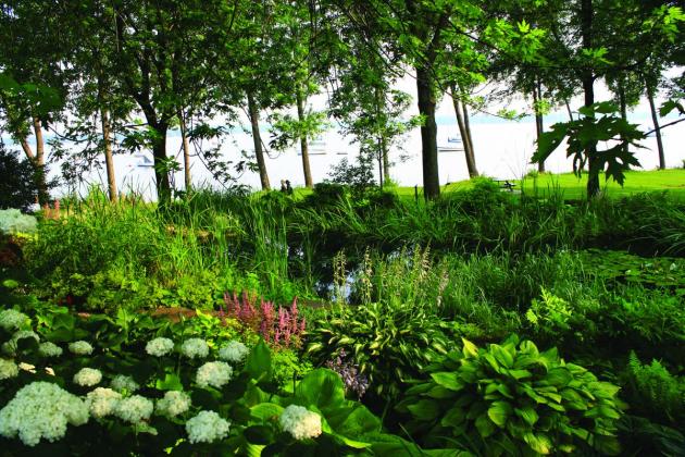
Parc La Fontaine
![]() Sherbrooke, Mont-Royal
Sherbrooke, Mont-Royal
 © Susan Moss Photography The park has been a part of Montréal’s history for a long time and has gained an outstanding reputation. Long ago, the field was used for military maneuvers; today, it features major public artworks, a number of fields for practicing various sports and venues for children’s theater productions and other performances. Add a few bodies of water and you’ll quickly why the park is so popular in summer!
Parc Maisonneuve
![]() Pie-IX, Viau
Pie-IX, Viau
 © Ville de Montréal, Alain Chagnon With Olympic Park and Space for Life for neighbours, Parc Maisonneuve is part of a vast tourist showplace. Featuring several jogging paths, it has numerous locations where you can enjoy either sun or shade. Twice the size of Parc Lafontaine, Parc Maisonneuve is both a very lively and very quiet location, in the heart of a vibrant Montréal neighbourhood, a short distance from Pie-IX and Viau métro stations, on the Green line.
Parc Angrignon
![]() Angrignon
Angrignon
 © TM - Madore - Daphné Caron Parc Angrignon is reminiscent of an English garden. Its majestic willows and pond only add to its calm, restful atmosphere. With nearly 10 km of pathways, it’s also a perfect location to spread out a tablecloth and enjoy a picnic. A must for your summer list, just outside its namesake métro station!
Parc Jarry
![]() De Castelnau
De Castelnau
 © TM - Madore - Daphné Caron Best known as a meeting ground for sports, Parc Jarry is for both active people and those wanting to relax. Located next to IGA Stadium where Rogers Cup tennis competitions are held, the park also has baseball fields, and large grassy areas where you can rest after a game. Did you know? The park celebrated its 90th anniversary in 2015. De Castelnau métro station is a short walking distance from the park, at the corner of boulevard Saint-Laurent and rue Gary-Carter.
Saint-Michel Environmental Complex
![]() D’Iberville +
D’Iberville +![]() 94
94 ![]() Jarry +
Jarry +![]() 193
193
 © Chinook Aventure The days of the old Miron quarry are long over. This vast tract of land is on its way to becoming the largest park in Montréal! To date, some 48 hectares are accessible, while a total of 192 are foreseen by 2020. Discover this area by starting at the TOHU, on rue Jarry Est, near the intersection with rue D’Iberville. To get there, you can exit at Jarry métro station and catch the 193 Jarry Est bus line that takes you directly to the TOHU, or at D’Iberville station, where you can board the 94 D’Iberville Nord bus line.