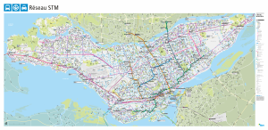
The map showing the entire STM transit system (PDF)
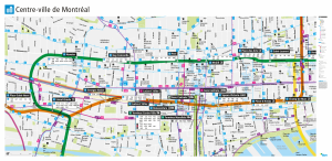
Transit routes in the downtown area (PDF)
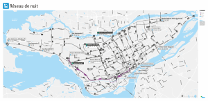
Map of nighttime bus routes (PDF)
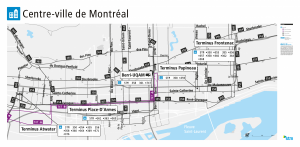
Downtown nighttime bus routes (PDF)
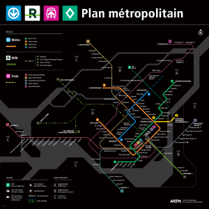
Metropolitain map (PDF)
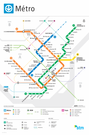
Métro network (PDF)